

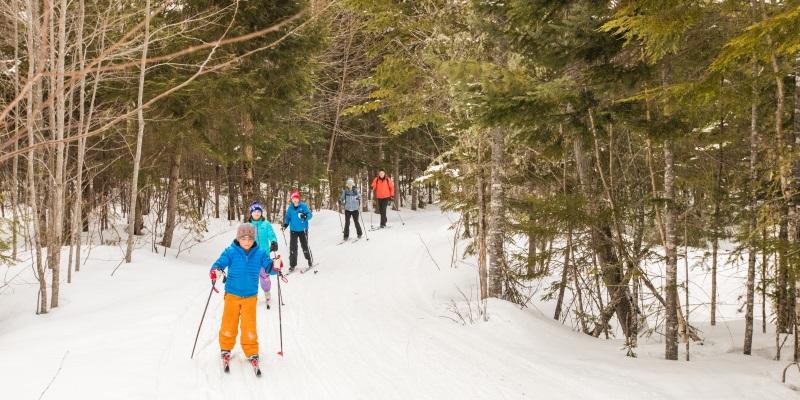
Maintained by a dedicated crew, the trail system at Maine Huts & Trails is unforgettable. Featuring winding switchbacks, sandy paths along mountain streams, natural bridges, and incredible views, the trails leading to the huts are some of the best in the world. When using the trail system, you’ll be following white and blue diamonds; white for the main trail which is groomed for skiing in the winter, and blue for ungroomed side trails.
Our trails connect with others in the area, managed by town of Carrabassett, Sugarloaf, and more. Please visit their pages for trail conditions, closures, and more.
Download Full Trail Map | Distance and Elevation Detail | Current trail conditions
<<View Our Trail Gallery>>
Find trails to your hut. Jump to:
GETTING TO STRATTON BROOK HUT
Closest Trailhead: Rte. 27/Stratton Brook Trailhead: 3.1 miles
Other Trailheads
Campbell Field Trailhead: 3.00 miles - NO OVERNIGHT PARKING
Sugarloaf Outdoor Center: 3.6 miles - NO OVERNIGHT PARKING
Airport Trailhead: 4.7 miles – (Drop point for gear shuttles to Stratton Brook Hut)
Via the Maine Hut Trail/Newton’s Revenge
Newton’s Revenge starts with a gentle uphill slowly getting steeper while winding its way up via switchbacks. Just before the start of the steep switchbacks, at about 1.5 miles, you'll see an intersection for Crommet’s Trail; taking a right here will take you to Poplar Hut. Continue up Newton’s Revenge towards Stratton Brook Hut. Take a left onto the service road and continue approximately 1/10 of a mile to the hut. Total distance is about 3 miles, or about 1.5 hours.
See Highlighted Map Section >>
Via Oak Knoll
Oak Knoll is intermediate-level single track with beautifully crafted stone switchbacks. After 0.25 miles on Newton’s Revenge, turn left onto Oak Knoll. You’ll cross over the service road twice, but continue straight. You'll come to a “T” intersection where Oak Knoll joins Newton’s Revenge. Take a right onto Newton’s Revenge, and continue until you connect to the service road. At this point you have two options to get to Stratton Brook hut: take a hard left and continue 100 yards to the hut, OR continue straight to a single track trail. This trail winds through the woods and exposes great views of Sugarloaf. Distance from Stratton Brook trailhead is just under 4 miles and will take about 3 hours hiking.
See Highlighted Map Section >>
Via Crommet’s Trail from Airport Trailhead
From Airport Trailhead, start down the open trail and cross over the Carrabassett River. At the trail intersection, turn left onto the Narrow Gauge Pathway. Continue for 0.8 miles on the pathway, then take a right onto the Crommet's Overlook Trail. The trail gradually ascends for the next 3 miles. Along the way, you will go by Crommet's Overlook, a great scenic spot to stop for lunch or a snack. The trail will intersect with Newton’s Revenge Trail after 3 miles; turn right and continue for .9 miles. Continue to your last intersection, about 1/10 of a mile; take a left to Stratton Brook hut. This section is steep, if you need to take off skis and walk up, please do so on the side of the trail to avoid damaging the groomed surface.
See Highlighted Map Section >>
Poplar Stream Hut to Stratton Brook Hut (7.6 miles, approx. 2-4 hours):
Exit Poplar Hut via the Hut cut-off and make a left onto the Maine Hut Trail. You will cross a foot bridge and continue downhill on the sloping and scenic Maine Hut Trail. Turn right onto the footbridge that crosses Poplar Stream. After the bridge, cross over the Carriage Road for a quick climb uphill. After 1.2 miles the Maine Hut Trail intersects with the Narrow Gauge Trail. At this intersection, continue on the Narrow Gauge for 0.8 miles, then veer right onto the Maine Hut Trail/Crommet’s Overlook Trail. Continue on this trail for 3.1 miles, but make sure to stop at Crommet’s Overlook for a scenic break. The trail ends at Newton’s Revenge, where you will take a right for a steep uphill ski for 0.7 miles to the Stratton Brook Hut.
See Highlighted Map Section >>
GETTING TO POPLAR HUT
Closest Trailhead: Airport Trailhead: 3.3 miles (Drop point for gear shuttles to Poplar Stream)
Other Trailheads
Campbell Field Trailhead: 6.5 miles - NO OVERNIGHT PARKING
Sugarloaf Outdoor Center: 7.8 miles - NO OVERNIGHT PARKING
Rte. 27/Stratton Brook: 8.1 miles
Flagstaff Trailhead: 10 miles
Poplar Hut via the Maine Hut Trail
Park at the Airport Trailhead, then follow the trail into the woods at the end of the airport runway. After crossing the bridge, you’ll encounter a four-way intersection. You'll be taking the Maine Hut Trail into the woods. The trail starts out flat and then increases to rolling terrain. After a quick downhill, the trail crosses the Carriage Road, and continues to a footbridge over Poplar Stream. Continue across the footbridge over Poplar Stream, then turn left. The trail starts out flat and begins to climb after the intersection with Larry’s Trail. In the winter, be on the watch for descending skiers. The trail levels off for the last mile, exposing nice views of Little Bigelow. Continue over a foot bridge and you’ll come to a Maine Huts & Trails sign. Take a right to the hut. Distance is about 2.2 miles.
See Highlighted Map Section >>
Via Warren’s Trail
Just before the footbridge take a left onto Warren’s Trail, following the west side of Poplar Stream. This winding trail ascends through ancient tree growth and makes for a great loop to see waterfalls and wildlife. Continue on Warren’s Trail until you come to the service road; take a right onto the service road and over Poplar Stream Bridge. Turn right after the bridge at the Maine Huts & Trails sign, this trail turns back to a single path through the woods. Continue straight on the trail; after 100 yards you'll come to an intersection. The trail from here is a gradual ascent. Continue to your next trail intersection; turn right. You're now on the Maine Hut Trail, just 0.03 miles to Poplar Hut.
See Highlighted Map Section >>
Via Larry’s Trail
Continue across the footbridge over Poplar Stream, take a left. You'll be on Maine Hut Trail for about 1 mile. This section starts out flat, with an uphill rise to the intersection with Larry’s Trail. Take a left onto Larry’s Trail, following the east side of Poplar Stream. You’ll encounter rolling hills until you come to a bridge crossing the South Branch of Poplar Stream. Approximately 100 yards after crossing the bridge, you'll come to an intersection. Bear left on Larry’s Trail to continue to Poplar Hut. Ascend the rock steps; at the top you'll see an intersection marker for Warren’s Trail, this trail will bring you back to the footbridge. Stay on Larry’s trail; it will continue uphill. Turn right at the next intersection, onto the Maine Hut Trail to Poplar Hut.
See Highlighted Map Section >>
Stratton Brook Hut to Poplar Stream Hut via Maine Hut Trail (7.6 miles, approx. 2-4 hours)
Carefully descend from Stratton Brook and take a sharp right onto Newton’s Revenge. When the trail intersects with the Maine Huts Trail/Crommett’s Overlook trail, turn left and follow sloping downhill for 3.1 miles until intersection with the Narrow Gauge Pathway. After .8 miles you will come to a 4-way intersection near a bridge: You'll be taking the Maine Hut Trail into the woods. The trail starts out flat and then increases to rolling terrain with a small uphill climb. After a quick downhill, the trail crosses the Carriage Road, and continues to a footbridge over Poplar Stream. Continue across the footbridge over Poplar Stream, then turn left. The trail starts out flat and begins to climb after the intersection with Larry’s Trail. The trail levels off for the last mile, exposing nice views of Little Bigelow. Continue over a foot bridge and you’ll come to a Maine Huts & Trails sign. Take a right to the hut. Total distance 7.6 miles.
See Highlighted Map Section >>
Flagstaff Lake Hut to Poplar Stream Hut: (11.8 miles, approx. 4-6 hours)
Exit Flagstaff Hut and go right onto the Maine Hut Trail. After 0.2 miles, stay right on the Maine Hut Trail at the intersection. The trail follows along the Dead River and crosses Long Falls Dam Road at 4 miles, then gradually climbs for another 1.6 miles to the Halfway Yurt. After a snack break and sit by the fire, descend from the Yurt for 1.0 miles for the next Long Falls Dam Road crossing. After another 1.3 miles cross East Flagstaff Road. NOTE: This 0.2 miles section between East Flagstaff Road and Carriage Road is shared with snowmobiles. Use caution! From the Carriage Road Xing to Poplar Hut is another 3.2 miles of level terrain. At the trail intersection, turn left and you will reach the hut in another 0.1 miles.
See Highlighted Map Section >>
GETTING TO FLAGSTAFF HUT
Closest Trailhead: Long Falls Dam/Flagstaff Trailhead: 2.2 miles (Drop point for gear shuttles to Flagstaff Lake)
Other Trailheads
Big Eddy/Grand Falls: 3.8 miles – CURRENTLY NOT GROOMED OR MAINTAINED. USE AT OWN RISK.
Flagstaff Hut via the Maine Hut Trail
From the trailhead proceed on the Maine Hut Trail (white signs) for about 0.2 miles; you'll come to a four way intersection. Take a right. The trail has some gentle inclines and declines, but is generally flat. At mile 1.4 you'll take a hard right, staying on the Maine Hut Trail. Continue for 0.3 miles then bear left, this will bring you to the service road. At 0.1 miles, take another left and continue on the Maine Hut Trail, just 0.2 miles from Flagstaff Hut. Total distance is 2.2 miles.
See Highlighted Map Section >>
Via the Shore Trail
From the kiosk, follow the white diamond blazed Main Hut Trail for 0.2 miles until you come to an intersection. Go straight onto The Shore Trail, which will follow the shoreline of Flagstaff Lake. At 1.4 miles you'll come to an intersection; bear left on the Shore Trail. In 0.3 miles you will come to another intersection; bear right and continue on the Shore Trail to Flagstaff Hut, 0.2 miles. Total distance is 2.1 miles.
See Highlighted Map Section >>
Poplar Stream to Flagstaff Lake Hut (11.8 miles, approx. 4-6 hours): Hiking and skiing
See Highlighted Map Section >>
Summer Bikers: After the second Carriage Road x-ing, follow the gravel road to E Flagstaff Road, and ride down Long Falls Dam Road until the trail to the hut appears 1.2 miles on the right.
GETTING TO GRAND FALLS HUT
Trail closed due to bridge work - Grand Falls Hut from the Big Eddy Trailhead (7.8 miles)
Note: Parking at the Big Eddy Trailhead is not managed by Maine Huts & Trails and is a public parking area.
From the parking area, turn left along the Long Falls Dam Road for 0.25 miles. Turn left onto Dead River Road (the dirt camp road) and continue 0.1 miles and watch for the trail to leave the dirt road on the left side. Turn left off the dirt camp road and continue 0.6 miles. The trail will then rejoin the dirt camp road for a short time; when you see a gate across the dirt camp road, keep left and follow the trail signs parallel to the Dead River for 5.5 miles before reaching the Tom & Kate Chappell Footbridge. The Tom & Kate Chappell Footbridge is a walking bridge that spans the Dead River. After the bridge, you can continue straight along the wider ski trail for 0.6 miles, or bear right onto the narrower Falls Trail for 0.3 miles, which will take you by the Grand Falls waterfall. Where the two trails converge again, continue on for another 0.2 miles to another bridge, which crosses Spencer Stream. After crossing this bridge, continue up the hill and along the trail another 0.9 miles to Grand Falls Hut.